|
The
Legend
tells you what the arrows Ū mean and how the terms
"right" and "left" are used. |
Sal Rei - Ponta do Sol |
||||||||
|
Follow a bird's flight with
your eyes and phantasy over plains and
shores, high above the roaring Atlantik - thats what waits for hikers at
the northers slopes of Pico VŪgia,
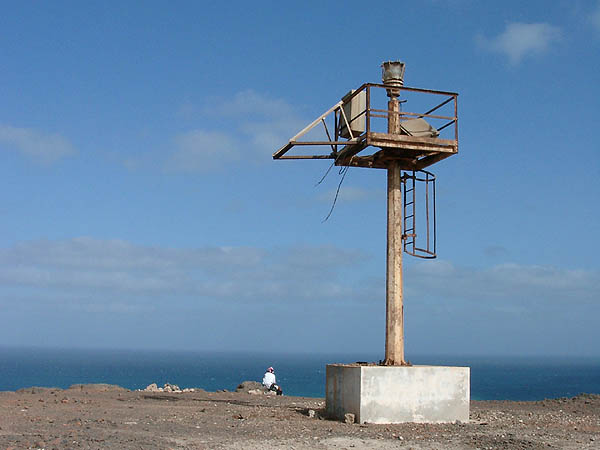
the cape of Ponta do Sol and the eagles rock, where the
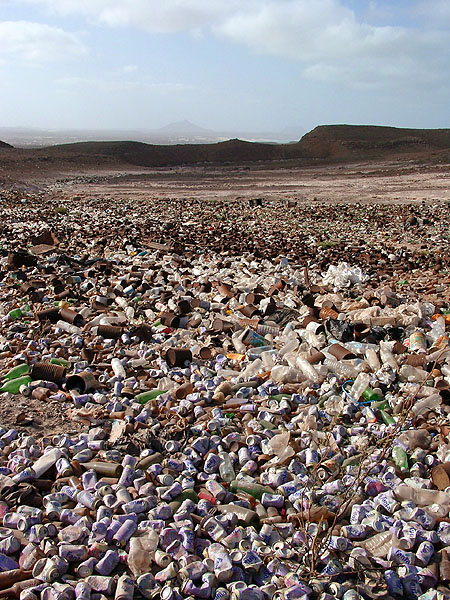
light house tower rustily errects into a blue sky. They are going to become a
nature reserve. Just to climb Ponta do Sol and walk back again cost you 3 Liter of Water and you need solid shoes, sun protection, map and compass. Binoculars are helpful for bird watchers! Starting Point is the quarter Riba díolt in the North of Sal Rei town.[Correi] About 200 m before reaching Hotel Marine Club ž there is a bifurcation and follow Ť the recently built access road to the grave yard [Faro09]. A smaller road climbst the next hill Ž and turns uphill at the next bifurcation ť to the old litter dumps (Lixeiras). Getting uglier and uglier, they acompany the road and so do we, even when the road deviates a little ž . Certainly it is preferable to follow it to the pass [Faro02] than trying to find a way through stony open terrain carved by erosion. There is another junction on ChŠ d' Ńgua Doce and our track continues uphills [FARO04] Ž. At the pass we enter the future nature reserve. Pico VŪgia is a nice extra asset for mountaineers with the most splendid panorama on the island! The light house is situated on top of the escarpment. While sitting and watching, Phaethon aethereus with long tails come to show their proficency in flying silently in the upstreaming flow of warm air. Desert ravens shout on every invador spotted in whar is their reserve. |